DRISHTI · NOTE 002.3
Everything on Earth Is Giving Something Away
Leaves reflect light nobody can see, fields run a fever when they are thirsty, and groundwater can be weighed from orbit. A satellite's job is to catch what the planet lets slip.
EARTHVISION LAB · ~7 MIN READ
SIGNALS
Landsat 1 launched with two instruments. The important one was a television camera built on proven weather-satellite technology. A faulty power circuit shut it down days after launch, and the experimental scanner that nobody fully trusted became the mission's only working eye.
That scanner recorded the ground not as a picture but as numbers, one measurement per wavelength per spot, and in doing so it quietly decided what Earth observation would be for the next fifty years.
Numbers were the right choice because a satellite never really sees a forest, a field or a flood. It catches something the forest, the field or the flood gives away: sunlight bouncing off it, heat rising from it, an echo of a pulse the satellite sent itself, or the faint pull of its weight. Four kinds of signal, caught from hundreds of kilometres up, account for nearly everything a satellite has ever told anyone about the planet.
REFLECTED LIGHT
Light the eye was never built for
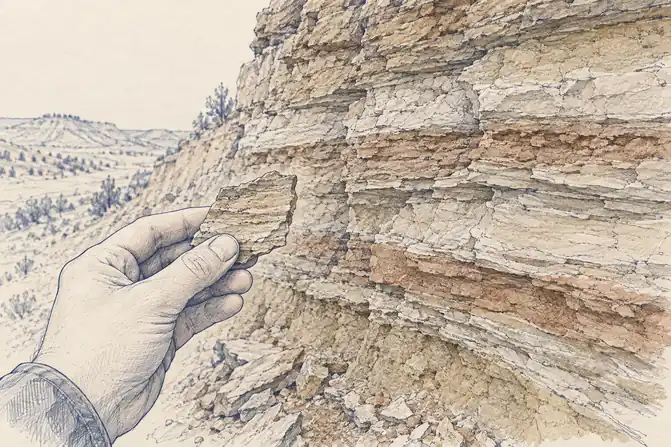
Human eyes see a narrow band of light, and most of what is interesting about a leaf happens just outside it. A healthy leaf absorbs red light to power photosynthesis and reflects near-infrared strongly because of the way its internal cells scatter it. Water does almost the reverse, swallowing infrared. To a person, a field and a pond can look similar at a distance. In near-infrared, the field glows and the pond is black.
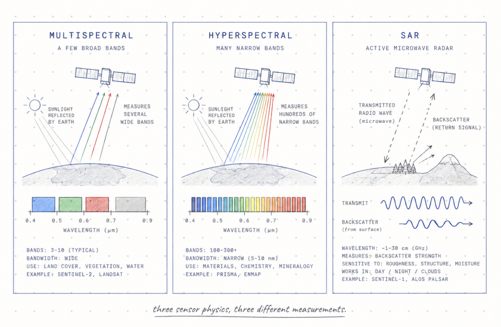
Landsat's scanner measured four bands. Europe's Sentinel-2 measures 13, from blue through near-infrared to the shortwave infrared, where moisture in leaves and soil shows up. Imaging spectrometers such as Germany's EnMAP, launched in 2022, record more than 200 narrow bands, enough to tell not only that clay is present but which clay mineral it is. Each extra band is another question the surface can be asked, at the cost of a much larger file for the same patch of ground.
The famous vegetation index, NDVI, comes after all this rather than instead of it. It is a ratio calculated from red and near-infrared reflectance, a compact way of saying how much leaf is there, not a direct reading of plant health. And because none of these wavelengths are visible, software paints them into colours the viewer can see. A healthy field often appears bright red because near-infrared has been assigned to red for the viewer's convenience. Nothing fake has happened. The measurement is real. The colour is a translation.
EMITTED HEAT
Taking the planet's temperature
Everything warm gives off infrared energy of its own, no sunlight required. Thermal instruments in orbit read that glow, which is why a satellite can find a fire at night, map a city that stays hot long after sunset, or take the temperature of an entire ocean basin before breakfast. It is the one kind of watching that works better in the dark.
The ocean was the first great beneficiary. Thermal radiometers on NOAA's polar-orbiting weather satellites have recorded sea surface temperature since 1981, building a climate record from trillions of individual readings of infrared radiance. Ships and buoys had measured the sea's temperature for a century, but only where they happened to be. From orbit, the whole surface of every ocean could be read in a few days, which is how the warm pools that drive El Niño became something forecasters could watch spreading rather than infer after the rains had already failed.
Plants turned out to have a temperature worth reading too. A leaf cools itself by letting water evaporate through tiny pores, much as a person sweats. When the soil runs dry the pores close, the cooling stops and the leaf warms up, often before it wilts or changes colour. ECOSTRESS, a NASA thermal instrument installed on the International Space Station in 2018, measures surface temperature in enough detail to see this happen field by field. A crop running a fever is thirsty, and for the first time the fever could be read from orbit before the farmer could see anything wrong.
WHAT WE SEND AND CATCH BACK
Shout, then listen for the echo
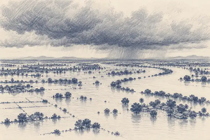
Light and heat are things the planet gives off. Radar is what happens when an instrument stops waiting and brings its own light. A synthetic aperture radar in orbit sends microwave pulses at the ground and measures what comes back, using the satellite's own motion to behave like an antenna far longer than the one it carries. Microwaves at these wavelengths pass through cloud largely undisturbed and do not care whether it is day. Europe's Sentinel-1 resolves detail down to about 5 metres, or covers a swath 400 kilometres wide. Calm water reflects the pulse away from the satellite and shows up dark, so a flooded valley under a week of storm cloud can be mapped overnight. No ground survey can do that across a region. No camera can either.
Radar echoes carry a second message that is even stranger. A returning radar wave arrives at a particular point in its cycle, its phase, which depends on the exact distance to the ground. Compare the phase from two passes over the same place, a technique called interferometric SAR or InSAR, and changes in that distance of a few millimetres show up as coloured bands across the image. The ground, it turns out, is rarely still. InSAR has watched volcanoes swell before eruptions, mapped how far each side of a fault moved in an earthquake, and caught farmland and cities sinking centimetres a year where aquifers beneath them are being pumped out. A surveyor with a level could measure one of those points. InSAR measures every point at once, including the ones on an active volcano.
Aim the pulse straight down and time the echo, and radar becomes a ruler. Satellite altimeters have measured global sea level this way since TOPEX/Poseidon in 1992, and it turns out the ocean surface has hills and valleys tens of centimetres high that a satellite more than a thousand kilometres up can see. Rivers were harder, being narrow and inconsiderately winding. SWOT, a NASA and French mission launched on 16 December 2022, times the echo with two antennas across a swath 50 kilometres wide on either side of the satellite, and measures the height of rivers wider than about 100 metres and lakes larger than about 62,500 square metres. Before SWOT, hydrologists had good height records for a few thousand of the world's lakes. The mission was built to raise that to at least a million.
WEIGHT
Weighing the planet by feeling it pull
The strangest signal of all is weight. GRACE, a NASA and German mission launched in March 2002, flew two satellites about 220 kilometres apart and measured the distance between them with microwaves, to within a fraction of the width of a hair. When the lead satellite passed over a heavier patch of Earth, it was pulled slightly ahead, and the gap changed. Water is heavy, so GRACE could weigh it. Between 2002 and 2008 it recorded more than 109 cubic kilometres of groundwater disappearing from beneath northern India, water no satellite could see and no well network could total, found by feeling the planet get lighter.
The same trick weighs ice. After GRACE ended in 2017, its successor GRACE-FO took over in 2018 with the same design, and between them they have measured Greenland shedding about 264 billion tonnes of ice a year since 2002, enough on its own to raise global sea level by about 0.8 millimetres every year. Nobody could weigh an ice sheet before. There was no scale large enough, and no place to stand while using it.
Light, heat, echoes and gravity: each instrument catches one thing the planet gives away and reports it faithfully. The forest, the thirsty field, the flood and the vanishing aquifer are conclusions drawn from those signals, which is exactly what makes them checkable. Put several signals side by side, the red and the infrared, the radar and the thermal band, the gravity and the river height, and conclusions that no single instrument could support become solid. None of these instruments sees the planet. Together, they come remarkably close.