DRISHTI · CHAPTER 5.4
Some Variables Exist Only as Inference
Root-zone moisture, groundwater and the water leaving a field are mapped every day. No instrument has ever measured most of those maps directly.
EARTHVISION LAB · ~17 MIN READ
OBSERVABLES AND STATES
A remote-sensing product can be named after a physical quantity the instrument never measured. Evapotranspiration, root-zone moisture, groundwater storage, biomass and carbon flux are familiar map layers, all estimated from signals that respond to them indirectly, combined with models and other data.
The map is about the variable. The detector recorded radiance, brightness temperature, travel time or phase.
The issue is observability: whether a hidden state can be uniquely recovered from the measurements available. In control theory and in inverse problems, a system is observable when its internal state can be worked out from what can be measured. Earth is generous enough to supply a great many states that are only partly observable, and the ground under our feet is the most familiar of them.
Inference can be excellent science. Weather analysis, ocean state estimates and most satellite geophysical products depend on it. The trouble begins when the lineage disappears and an estimated state is presented as though an instrument met it directly. A number can be precise without ever having been observed in the ordinary sense of the word.
THE SUBSURFACE
The ground is not a surface
A satellite can map a continent while being almost completely unable to see what is happening one metre beneath it. That is not a resolution problem. It is physics: most signals used for Earth observation interact with the surface, the vegetation or the top few centimetres of soil long before they reach roots, aquifers, buried pipes or rock. The word ground suggests a boundary. In hydrology, agriculture and geology it is the top of a volume, in which water soaks down, roots extract it, aquifers rise and fall, sediments compact and heat and chemistry move about out of sight.
Soil moisture shows the limit precisely. NASA's SMAP satellite carries an L-band microwave radiometer sensitive to roughly the top 0 to 5 centimetres of soil, while crops and trees often draw water from far deeper. The Level-4 product described in Volume 4 estimates the root zone, defined as roughly the top metre, by assimilating that thin observation into a land-surface model. The design is sound and the product excellent. But the satellite did not send a signal down a metre and get the water content back. The deeper state is a model-informed inference, a different kind of object from a measurement, wearing the same units.
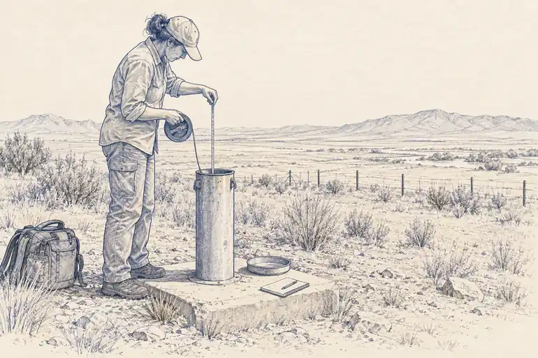
Groundwater is harder still. The reservoir can extend hundreds of metres down, and pumping happens through millions of wells whose withdrawals are rarely metered continuously. The most literal observation is still a monitoring well: lower an instrument and read the water level, which is direct, local and inconveniently both. A regional aquifer cannot be represented by one well any more than an atmosphere by one thermometer, so hydrogeologists combine networks of wells with geology, pumping records, rainfall, river flow and models. USGS adds GPS, borehole extensometers and the InSAR of Volume 2, which catches land sinking where aquifers are pumped.
The sinking is not the volume of water. How much the ground drops depends on the sediments, the mechanics of the aquifer and whether the compaction is temporary or permanent. Subsidence is evidence about what happened below, not a window into it. The ground has politely supplied a symptom, and the diagnosis is left to a model.
The ground is not where observation ends. It is where direct observation becomes expensive enough that inference starts looking like a surface.
OPENET AND FLUX TOWERS
Evapotranspiration is water leaving without a meter
Evapotranspiration, or ET, is water returning to the air by evaporation from surfaces and transpiration from plants. It is one of the largest terms in an agricultural water budget and one of the least convenient to measure across millions of fields. No satellite counts the litres leaving each parcel. Remote methods infer the flux from related quantities. Some use surface temperature and the energy balance: a well-watered, actively transpiring field spends more of its incoming energy evaporating water, so it stays cooler than a dry one under the same sun. Others use vegetation, radiation, weather and empirical relationships in various combinations.
OpenET runs an ensemble of six established satellite-driven ET models rather than pretending one formula owns the answer, producing field-scale estimates at 30 metres across the western United States, with broader U.S. coverage in current products. The inputs are satellite observations, weather data and supporting information. The output is an estimate of how much water each field consumed. It looks exactly like any other map layer, a number in millimetres in every pixel, and underneath each number is an inverse calculation about a flux nobody saw. The water had left the field by the time the product named it.
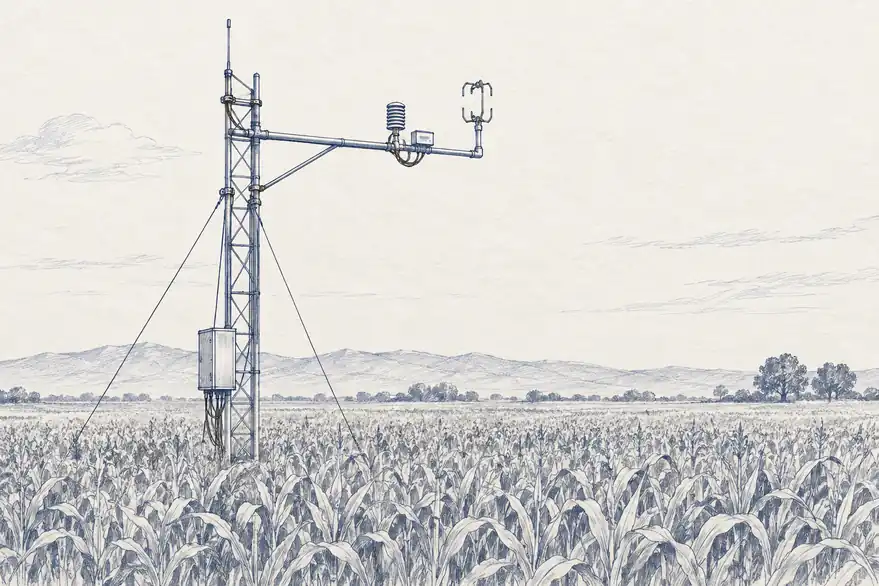
OpenET's models are checked against eddy-covariance flux towers, instruments that estimate exchanges of water vapour and energy by measuring rapid fluctuations in vertical wind and air properties above a site. A tower is local and expensive compared with a satellite map, which is exactly why it is useful as an independent reference. A 2024 USGS-led assessment compared OpenET against 152 ground stations. At cropland sites the ensemble's mean absolute error was 15.8 millimetres a month, about 17% of the observed ET, with an r-squared of 0.9. Shrubland and forest sites showed more disagreement among the models and lower accuracy.
Those numbers make the structure visible. The map is credible not because a satellite saw evapotranspiration, but because estimates built from what satellites can see agree well enough with independent flux measurements at many sites. Credibility lives in the relationship between systems, and so validation has a geography: well tested over irrigated cropland, less constrained over forests, wetlands and unusual climates. A global-looking variable inherits the distribution of places where somebody could build and maintain a tower.
IDENTIFIABILITY
Different hidden worlds can produce similar measurements
The hard version of an inverse problem appears when several hidden states produce nearly the same observation. A warm surface might mean dry soil, sparse vegetation, unusual wind or a change in incoming radiation. The measurement is real. The explanation is not uniquely encoded in it.
Hydrologists call a related problem equifinality: different combinations of parameters or processes reproduce the same observed output. A model fitted to a river's flow can match the river perfectly while getting the split between soaking in, groundwater and evaporation wrong. Good agreement at the outlet does not guarantee that any hidden reservoir upstream is correct.
Additional kinds of evidence help because each constrains a different part of the same water balance: surface temperature, microwave soil moisture, vegetation, rainfall, flux towers and stream gauges. Each new observation removes some of the plausible hidden states. It rarely removes all of them.
The key question for any planetary layer is therefore not only how accurate it is, but how many different physical states remain consistent with the evidence behind it. Two products with the same numerical error can have very different identifiability, and a map of the ground can be precise at 10 metres while resting on a single proxy, or exact at one borehole and unknown fifty kilometres away. Spatial detail and strength of evidence are different axes.
DIRECT, RETRIEVED, ASSIMILATED, MODELLED
Every geophysical layer needs an evidence lineage
A practical way to keep the distinction is to record how far a quantity sits from the instrument. Some values are direct observables, such as a radiance or a radar phase. Some are retrievals, derived from an observation by an algorithm. Some are assimilated states, produced by combining observations with a dynamical model. Others are forecasts or scenarios, with no simultaneous measurement at all.
These categories are not a ranking. A retrieved temperature can be more useful than the raw radiance, an assimilated root-zone estimate can beat any model with no satellite constraint, and a forecast is indispensable precisely because the future cannot be observed yet. The lineage tells the user what kind of claim a number is making.
Land is routinely shown as aligned layers: soil moisture, groundwater stress, root-zone water, carbon stock, subsidence. The layers line up neatly on the map. The evidence beneath them does not, coming variously from a satellite's skin-deep reading, a scatter of wells, surface deformation and a model. Volume 4 argued that uncertainty has to survive the interfaces between systems. Observability adds another field to those interfaces: the type of evidence. A downstream system should know whether its input was measured, retrieved, interpolated across a gap or generated by a model, or the whole pipeline can become very confident about a variable nobody ever saw.
The map may contain a value everywhere. Reality is under no obligation to have supplied a measurement for each one.